World Facts Index
 Once
part of Spain's vast empire in the New World, Honduras became an independent
nation in 1821. After two and a half decades of mostly military rule, a freely
elected civilian government came to power in 1982. During the 1980s, Honduras
proved a haven for anti-Sandinista contras fighting the Marxist Nicaraguan
Government and an ally to Salvadoran Government forces fighting leftist
guerrillas. The country was devastated by Hurricane Mitch in 1998, which killed
about 5,600 people and caused approximately $2 billion in damage. Once
part of Spain's vast empire in the New World, Honduras became an independent
nation in 1821. After two and a half decades of mostly military rule, a freely
elected civilian government came to power in 1982. During the 1980s, Honduras
proved a haven for anti-Sandinista contras fighting the Marxist Nicaraguan
Government and an ally to Salvadoran Government forces fighting leftist
guerrillas. The country was devastated by Hurricane Mitch in 1998, which killed
about 5,600 people and caused approximately $2 billion in damage.
Geography of Honduras
|
Location:
|
Middle America, bordering
the Caribbean Sea, between Guatemala and Nicaragua and bordering the
Gulf of Fonseca (North Pacific Ocean), between El Salvador and Nicaragua |
|
Coordinates:
|
15 00 N, 86 30 W |
|
Area:
|
total: 112,090 sq km
land: 111,890 sq km
water: 200 sq km |
|
Area comparative:
|
slightly larger than
Tennessee |
|
Land boundaries:
|
total: 1,520 km
border countries: Guatemala 256 km, El Salvador 342 km, Nicaragua
922 km |
|
Coastline:
|
820 km |
|
Maritime claims:
|
contiguous zone: 24
NM
territorial sea: 12 NM
continental shelf: natural extension of territory or to 200 NM
exclusive economic zone: 200 NM |
|
Climate:
|
subtropical in lowlands,
temperate in mountains |
|
Terrain:
|
mostly mountains in
interior, narrow coastal plains |
|
Elevation extremes:
|
lowest point:
Caribbean Sea 0 m
highest point: Cerro Las Minas 2,870 m |
|
Natural resources:
|
timber, gold, silver,
copper, lead, zinc, iron ore, antimony, coal, fish, hydropower |
|
Natural hazards:
|
frequent, but generally
mild, earthquakes; extremely susceptible to damaging hurricanes and
floods along the Caribbean coast |
|
Environment current issues:
|
urban population expanding;
deforestation results from logging and the clearing of land for
agricultural purposes; further land degradation and soil erosion
hastened by uncontrolled development and improper land use practices
such as farming of marginal lands; mining activities polluting Lago de
Yojoa (the country's largest source of fresh water), as well as several
rivers and streams, with heavy metals |
|
Geography - note:
|
has only a short Pacific
coast but a long Caribbean shoreline, including the virtually
uninhabited eastern Mosquito Coast
|
More Geography
Population of Honduras
|
Population:
|
7,639,327 (July 2008 est.) |
|
Age structure:
|
0-14 years: 39.9% (male 1,491,170/female 1,429,816)
15-64 years: 56.7% (male 2,076,727/female 2,077,975)
65 years and over: 3.4% (male 113,747/female 137,061) |
|
Median age:
|
19.5 years |
|
Growth rate:
|
2.16% |
|
Infant mortality:
|
25.82 deaths/1,000 live births |
|
Life expectancy at birth:
|
total population: 69.33 years
male: 67.75 years
female: 70.98 years |
|
Fertility rate:
|
3.59 children born/woman |
|
Nationality:
|
noun: Honduran(s)
adjective: Honduran |
|
Ethnic groups:
|
mestizo (mixed Amerindian and European)
90%, Amerindian 7%, black 2%, white 1% |
|
Religions:
|
Roman Catholic 97%, Protestant minority |
|
Languages:
|
Spanish, Amerindian dialects |
|
Literacy:
|
definition: age 15 and over can read
and write
total population: 76.2%
male: 76.1%
female: 76.3%
|
Government
|
Country name:
|
conventional long form: Republic of
Honduras
local long form: Republica de Honduras |
|
Government type:
|
democratic constitutional republic |
|
Capital:
|
Tegucigalpa |
|
Administrative divisions:
|
18 departments (departamentos, singular -
departamento); Atlantida, Choluteca, Colon, Comayagua, Copan, Cortes, El Paraiso,
Francisco Morazan, Gracias a Dios, Intibuca, Islas de la Bahia, La Paz, Lempira,
Ocotepeque, Olancho, Santa Barbara, Valle, Yoro |
|
Independence:
|
15 September 1821 (from Spain) |
|
National holiday:
|
Independence Day, 15 September (1821) |
|
Constitution:
|
11 January 1982, effective 20 January 1982;
amended 1995 |
|
Legal system:
|
rooted in Roman and Spanish civil law with
increasing influence of English common law; recent judicial reforms include abandoning
Napoleonic legal codes in favor of the oral adversarial system; accepts ICJ jurisdiction,
with reservations |
|
Suffrage:
|
18 years of age; universal and compulsory |
|
Executive branch:
|
chief of state: President Manuel ZELAYA Rosales
(since 27 January 2006); Vice President Elvin Ernesto SANTOS Ordonez (since 27
January 2006); note - the president is both the chief of state and head of
government
head of government: President Manuel ZELAYA Rosales (since 27 January 2006);
Vice President Elvin Ernesto SANTOS Ordonez (since 27 January 2006)
cabinet: Cabinet appointed by president
elections: president elected by popular vote for a four-year term; election last
held 27 November 2005 (next to be held in November 2009). |
|
Legislative branch:
|
unicameral National Congress or Congreso Nacional (128
seats; members are elected proportionally to the number of votes their party's
presidential candidate receives to serve four-year terms) |
|
Judicial branch:
|
Supreme Court of Justice or Corte Suprema
de Justicia (judges are elected for seven-year terms by the National Congress) |
Economy
Honduras, the second poorest country in Central America and one of the
poorest countries in the Western Hemisphere, with an extraordinarily unequal
distribution of income and massive unemployment, is banking on expanded trade
under the US-Central America Free Trade Agreement (CAFTA) and on debt relief
under the Heavily Indebted Poor Countries (HIPC) initiative. Despite
improvements in tax collections, the government's fiscal deficit is growing
due to increases in current expenditures and financial losses from the state
energy and telephone companies. Honduras is the fastest growing remittance
destination in the region with inflows representing over a quarter of GDP,
equivalent to nearly three-quarters of exports. The economy relies heavily on
a narrow range of exports, notably bananas and coffee, making it vulnerable to
natural disasters and shifts in commodity prices, however, investments in the
maquila and non-traditional export sectors are slowly diversifying the
economy. Growth remains dependent on the economy of the US, its largest
trading partner, and on reduction of the high crime rate, as a means of
attracting and maintaining investment.
|
GDP:
|
$32.26 billion (2007 est.) |
|
GDP growth rate:
|
4.2% |
|
GDP per capita:
|
$4,300 |
|
GDP composition by sector:
|
agriculture: 13.9%
industry: 31.2%
services: 54.9% |
|
Inflation rate:
|
8.8% |
|
Labor force:
|
2.54 million |
|
Labor force - by occupation:
|
agriculture 34%, industry 21%, services 45% |
|
Unemployment:
|
28% |
|
Budget:
|
revenues: $1.693 billion
expenditures: $1.938 billion |
|
Electricity production by source:
|
fossil fuel: 50.2%
hydro: 49.8%
other: 0% |
|
Industries:
|
sugar, coffee, textiles, clothing, wood
products |
|
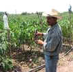
Agriculture:
|
bananas, coffee, citrus; beef; timber;
shrimp |
|
Exports:
|
coffee, shrimp, bananas, gold, palm oil, fruit, lobster,
lumber |
|
Export partners:
|
US 75.3%, El Salvador 3.5%, Germany 2.6% |
|
Imports:
|
machinery and transport equipment, industrial raw
materials, chemical products, fuels, foodstuffs |
|
Import partners:
|
US 54.5%, Guatemala 5%, Mexico 3.9% |
|
Currency:
|
lempira (HNL) |
SOURCES: The CIA World Factbook, U.S. Department of State, Area Handbook of the US Library of Congress
Copyright 2004 - 2008 worldfacts.us |