World Facts Index
 Eritrea
was awarded to Ethiopia in 1952 as part of a federation. Ethiopia's annexation
of Eritrea as a province 10 years later sparked a 30-year struggle for
independence that ended in 1991 with Eritrean rebels defeating governmental
forces; independence was overwhelmingly approved in a 1993 referendum. A
two-and-a-half-year border war with Ethiopia that erupted in 1998 ended under UN
auspices in December 2000. Eritrea currently hosts a UN peacekeeping operation
that is monitoring a 25 km-wide Temporary Security Zone (TSZ) on the border with
Ethiopia. An international commission, organized to resolve the border dispute,
posted its findings in 2002. However, both parties have been unable to reach
agreement on implementing the decision. On 30 November 2007, the
Eritrea-Ethiopia Boundary Commission remotely demarcated the border by
coordinates and dissolved itself, leaving Ethiopia still occupying several
tracts of disputed territory, including the town of Badme. Eritrea accepted the
EEBC's "virtual demarcation" decision and called on Ethiopia to remove
its troops from the TSZ which it states is Eritrean territory. Ethiopia has not
accepted the virtual demarcation decision. Eritrea
was awarded to Ethiopia in 1952 as part of a federation. Ethiopia's annexation
of Eritrea as a province 10 years later sparked a 30-year struggle for
independence that ended in 1991 with Eritrean rebels defeating governmental
forces; independence was overwhelmingly approved in a 1993 referendum. A
two-and-a-half-year border war with Ethiopia that erupted in 1998 ended under UN
auspices in December 2000. Eritrea currently hosts a UN peacekeeping operation
that is monitoring a 25 km-wide Temporary Security Zone (TSZ) on the border with
Ethiopia. An international commission, organized to resolve the border dispute,
posted its findings in 2002. However, both parties have been unable to reach
agreement on implementing the decision. On 30 November 2007, the
Eritrea-Ethiopia Boundary Commission remotely demarcated the border by
coordinates and dissolved itself, leaving Ethiopia still occupying several
tracts of disputed territory, including the town of Badme. Eritrea accepted the
EEBC's "virtual demarcation" decision and called on Ethiopia to remove
its troops from the TSZ which it states is Eritrean territory. Ethiopia has not
accepted the virtual demarcation decision.
Geography of Eritrea
|
Location:
|
Eastern Africa, bordering
the Red Sea, between Djibouti and Sudan |
|
Coordinates:
|
15 00 N, 39 00 E |
|
Area:
|
total: 121,320 sq km
water: 0 sq km
land: 121,320 sq km |
|
Area comparative:
|
slightly larger than
Pennsylvania |
|
Land boundaries:
|
total: 1,626 km
border countries: Djibouti 109 km, Ethiopia 912 km, Sudan 605 km |
|
Coastline:
|
2,234 km total; mainland on
Red Sea 1,151 km, islands in Red Sea 1,083 km |
|
Maritime claims:
|
territorial sea: 12
NM |
|
Climate:
|
hot, dry desert strip along
Red Sea coast; cooler and wetter in the central highlands (up to 61 cm
of rainfall annually); semiarid in western hills and lowlands; rainfall
heaviest during June-September except in coastal desert |
|
Terrain:
|
dominated by extension of
Ethiopian north-south trending highlands, descending on the east to a
coastal desert plain, on the northwest to hilly terrain and on the
southwest to flat-to-rolling plains |
|
Elevation extremes:
|
lowest point: near
Kulul within the Denakil depression -75 m
highest point: Soira 3,018 m |
|
Natural resources:
|
gold, potash, zinc, copper,
salt, possibly oil and natural gas, fish |
|
Natural hazards:
|
frequent droughts; locust
swarms |
|
Environment current issues:
|
deforestation;
desertification; soil erosion; overgrazing; loss of infrastructure from
civil warfare |
|
Geography - note:
|
strategic geopolitical
position along world's busiest shipping lanes; Eritrea retained the
entire coastline of Ethiopia along the Red Sea upon de jure independence
from Ethiopia on 24 May 1993
|
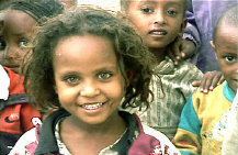
Population of Eritrea
|
Population:
|
5,502,026 (July 2008 est.) |
|
Age structure:
|
0-14 years: 44% (male 1,059,458/female 1,046,955)
15-64 years: 52.5% (male 1,244,153/female 1,268,189)
65 years and over: 3.5% (male 82,112/female 86,127) |
|
Median age:
|
17.8 years |
|
Growth rate:
|
2.47% |
|
Infant mortality:
|
46.3 deaths/1,000 live births |
|
Life expectancy at birth:
|
total population: 59.03 years
male: 57.44 years
female: 60.66 years |
|
Fertility rate:
|
5.08 children born/woman |
|
Nationality:
|
noun: Eritrean(s)
adjective: Eritrean |
|
Ethnic groups:
|
ethnic Tigrinya 50%, Tigre and Kunama 40%,
Afar 4%, Saho (Red Sea coast dwellers) 3%, other 3% |
|
Religions:
|
Muslim, Coptic Christian, Roman Catholic,
Protestant |
|
Languages:
|
Afar, Arabic, Tigre and Kunama, Tigrinya,
other Cushitic languages |
|
Literacy:
|
total population: 58.6%
male: 69.9%
female: 47.6%
|
Government
|
Country name:
|
conventional long form: State of
Eritrea
local long form: Hagere Ertra
former: Eritrea Autonomous Region in Ethiopia
local short form: Ertra |
|
Government type:
|
transitional government
note: following a successful referendum on independence for the Autonomous Region
of Eritrea on 23-25 April 1993, a National Assembly, composed entirely of the People's
Front for Democracy and Justice or PFDJ, was established as a transitional legislature; a
Constitutional Commission was also established to draft a constitution; ISAIAS Afworki was
elected president by the transitional legislature; the constitution, ratified in May 1997,
did not enter into effect, pending parliamentary and presidential elections; parliamentary
elections had been scheduled in December 2001, but were postponed indefinitely; currently
the sole legal party is the People's Front for Democracy and Justice (PFDJ) |
|
Capital:
|
Asmara (formerly Asmera) |
|
Administrative divisions:
|
6 regions (regions, singular - region);
Central, Anelba, Southern Red Sea, Northern Red Sea, Southern, Gash-Barka |
|
Independence:
|
24 May 1993 (from Ethiopia) |
|
National holiday:
|
Independence Day, 24 May (1993) |
|
Constitution:
|
the transitional constitution, decreed on
19 May 1993, was replaced by a new constitution adopted on 23 May 1997, but not yet
implemented |
|
Legal system:
|
primary basis is the Ethiopian legal code
of 1957, with revisions; new civil, commercial, and penal codes have not yet been
promulgated; also relies on customary and post-independence-enacted laws and, for civil
cases involving Muslims, Sharia law |
|
Suffrage:
|
18 years of age; universal |
|
Executive branch:
|
chief of state: President ISAIAS Afworki (since
8 June 1993); note - the president is both the chief of state and head of
government and is head of the State Council and National Assembly
head of government: President ISAIAS Afworki (since 8 June 1993)
cabinet: State Council is the collective executive authority; members appointed
by the president
elections: president elected by the National Assembly for a five-year term
(eligible for a second term); the most recent and only election held 8 June 1993
(next election date uncertain as the National Assembly did not hold a
presidential election in December 2001 as anticipated) |
|
Legislative branch:
|
unicameral National Assembly (150 seats; term limits not
established) |
|
Judicial branch:
|
High Court - regional, subregional, and
village courts; also have military and special courts |
Economy
Since independence from Ethiopia in 1993, Eritrea has faced the economic
problems of a small, desperately poor country, accentuated by the recent
implementation of restrictive economic policies. Eritrea has a command economy
under the control of the sole political party, the People's Front for
Democracy and Justice (PFDJ). Like the economies of many African nations, the
economy is largely based on subsistence agriculture, with 80% of the
population involved in farming and herding. The Ethiopian-Eritrea war in
1998-2000 severely hurt Eritrea's economy. GDP growth fell to zero in 1999 and
to -12.1% in 2000. The May 2000 Ethiopian offensive into northern Eritrea
caused some $600 million in property damage and loss, including losses of $225
million in livestock and 55,000 homes. The attack prevented planting of crops
in Eritrea's most productive region, causing food production to drop by 62%.
Even during the war, Eritrea developed its transportation infrastructure,
asphalting new roads, improving its ports, and repairing war-damaged roads and
bridges. Since the war ended, the government has maintained a firm grip on the
economy, expanding the use of the military and party-owned businesses to
complete Eritrea's development agenda. The government strictly controls the
use of foreign currency, limiting access and availability. Few private
enterprises remain in Eritrea. Eritrea's economy is heavily dependent on taxes
paid by members of the diaspora. Erratic rainfall and the delayed
demobilization of agriculturalists from the military continue to interfere
with agricultural production, and Eritrea's recent harvests have not been able
to meet the food needs of the country. The government continues to place its
hope for additional revenue on the development of several international mining
projects. Despite difficulties for international companies in working with the
Eritrean government, a Canadian mining company signed a contract with the GSE
in 2007 and plans to begin mineral extraction in 2010. Eritrea also
anticipates opening a free trade zone at the port of Massawa in 2008.
Eritrea's economic future depends upon its ability to master social problems
such as illiteracy, unemployment, and low skills, and more importantly, on the
government's willingness to support a true market economy.
|
GDP:
|
$3.619 billion (2007 est.) |
|
GDP growth rate:
|
2% |
|
GDP per capita:
|
$1,000 |
|
GDP composition by sector:
|
agriculture: 10.2%
industry: 25.4%
services: 64.3% |
|
Inflation rate:
|
15% |
|
Labor force - by occupation:
|
agriculture: 80%
industry and services: 20% |
|
Budget:
|
revenues: $248.8 million
expenditures: $409.4 million |
|
Electricity production by source:
|
fossil fuel: 100%
hydro: 0%
other: 0% |
|
Industries:
|
food processing, beverages, clothing and textiles, salt,
cement, commercial ship repair |
|
Agriculture:
|
sorghum, lentils, vegetables, corn, cotton,
tobacco, coffee, sisal; livestock, goats; fish |
|
Exports:
|
livestock, sorghum, textiles, food, small
manufactures (2000) |
|
Export partners:
|
Ireland 25.7%, US 17.9%, Italy 16%, Turkey 6.2% |
|
Imports:
|
machinery, petroleum products, food,
manufactured goods (2000) |
|
Import partners:
|
Malaysia 21.3%, Italy 13.7%, Egypt 8.4%, India 7.8%, Japan
6.5%, Germany 5.4%, China 4% |
|
Currency:
|
nakfa (ERN) |
SOURCES: The CIA World Factbook, U.S. Department of State, Area Handbook of the US Library of Congress
Copyright 2004 - 2008 worldfacts.us |